|
In the 1870's a shepherd boy locates
a ledge near the east side of the summit of Tioga Pass, just
east of the boundary of modern day Yosemite National Park, high
in the Sierra Nevada. Preliminary assays prove the
ore worthless, but in 1877 the persistence of the shepherd pay
off when new samples prove it to be of worth.
Soon unemployed miners from Aurora,
NV pick up on the rumor that ore it to be found in the Sierra,
and so they flock southwest to the crest of the range, begin
prospecting, and soon the Tioga Mining District is formed. The
Great Sierra Mining Company is formed and a townsite is platted,
christened Bennettville, after Thomas Bennett Jr., the president
of the mining company.
A post office opened March 13, 1882
and a telegraph line was strung up and over the mountains from
nearby Lundy. Surveys begin for a 56- mile road from the west
from Crocker's Station (near modern day Big Oak Flat)
to town, the road was called the Great Sierra Wagon Road. All
the while, miners drill and blast into solid granite, searching
for the most
valuable ore.
The good ore proved to be locked deep
into solid granite, and it was decided to tunnel deep into the
Sierra crest to find it. The company ran
into financial trouble and by July 3, 1884 closed down, but not
before they had drilled and blasted their way through 1,784 feet
of solid stone.
Miners were laid off and tools were placed inside the tunnel,
and then sealed off. The post office closed in November.
In 1889, a new company, the Great Sierra
Consolidated Silver Company, began to work the old tunnel, before
long the tunnel was drilled in an additional 216 feet, but the
ore proved still elusive. The company's backers called a halt
to the work, but kept a watchman on the payroll.
The company remained solvent throughout the following years,
but one by one the principal stockholders died off and the mine
was largely
forgotten. In 1933, a widow of one of them decided to give the
old tunnel yet another try, but she too, died before anything
valuable was
realized, and work again stopped.
The only thing substantial that arose
from all this drilling was the Great Sierra Wagon Road. Maintenance
of the road stopped with the work
on the mines, but was resurrected with the coming of the automobile.
The National Park Service embraced the auto as a way for citizens
and tourists from abroad alike to enjoy America's national wonders,
and in
1915 Stephen T. Mather, later director of the National Park Service,
purchased the Great Sierra Wagon Road in behalf of Yosemite National
Park. The road was improved to allow automobiles to travel, although
early photos show it to be for the adventurous: one lane wide,
serpentine and no guard rails to prevent those thousand foot
plus drop-offs. Today,
California State Route 120 over Tioga Pass allows easy transportation
of millions of visitors each summer (the route is closed from
the first
substantial snowfall after November 1 and reopens normally in
late May -- although in bad winter years it has taken until late
July to cut through 30+-foot deep snow drifts) enroute to the
wonders of Yosemite.
Today, several wooden buildings accent
the alpine mountain top. Nearby, an empty portal into the backbone
of the Sierra pours forth water and ice instead of silver and
gold.
___________________
David A. Wright
Great Basin Research
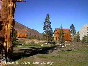
Bennettville, view east. July 3, 1999.
Courtesy David A. Wright
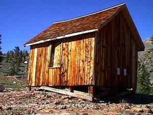
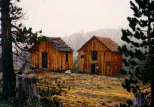
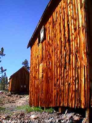
Smaller of two structures remaining at Bennettville. July 3, 1999.
Courtesy David A. Wright
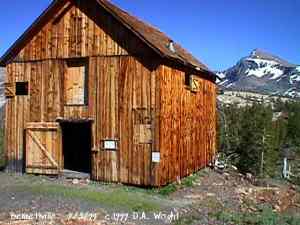
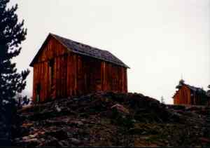
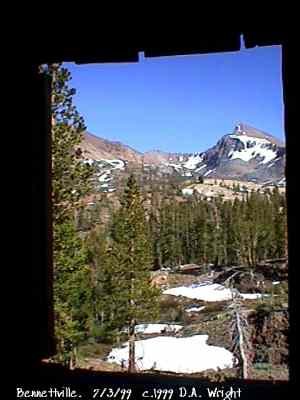
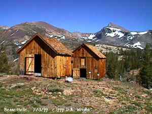
Larger of two structures remaining at Bennettville. 13,053 foot high Mt.
Dana in background. July 3, 1999.
Courtesy David A. Wright
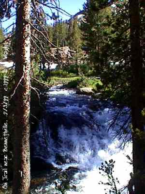
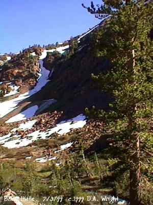
Some of the beauty found along the short trail to Bennettville. July 3,
1999.
Courtesy David A. Wright
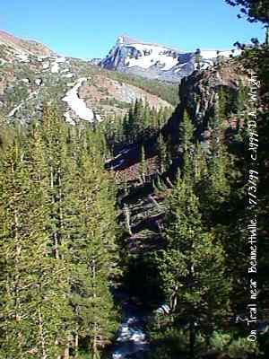
A scene along the trail to Bennettville, which includes 13,053 foot high
Mt. Dana. July 3, 1999.
Courtesy David A. Wright
|
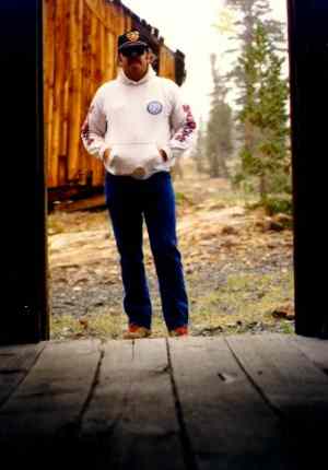
David A. Wright at Bennetville on a snowy September afternoon.
September 1990.
Courtesy David A. Wright
Bennettville. September 1990.
Courtesy David A. Wright
Bennettville. September 1990.
Courtesy David A. Wright
Bennettville. September 1990.
Courtesy David A. Wright
First look at Bennettville from trail. July 3, 1999.
Courtesy David A. Wright
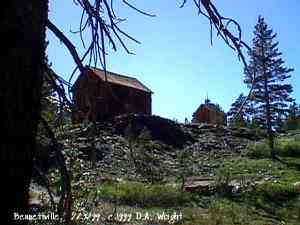
Bennettville. July 3, 1999.
Courtesy David A. Wright
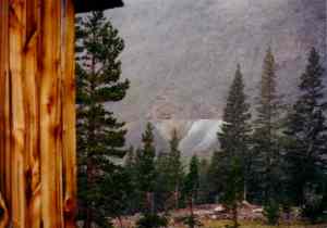
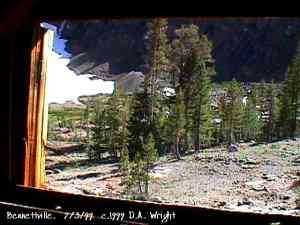
View from Bennettville window to Mount Dana, elevation 13,053 feet, on
Yosemite National Park boundary.
Courtesy David A. Wright
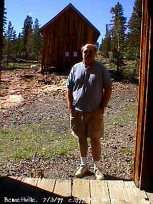
Bennettville hasn't changed much in the past 9 years, but I have! Compare
with photo above. July 3, 1999.
Courtesy David A. Wright
View from upper floor window of Bennettville structure west to primary
mine. July 3, 1999.
Courtesy David A. Wright
Bennettville. View south toward Mount Dana, 13,053 feet. July 3, 1999.
Courtesy David A. Wright
Bennettville mining area. July 3, 1999.
Courtesy David A. Wright
|