COLOMA
|
COLOMA |
|
| |
| NAME: Coloma COUNTY: Missoula ROADS: 2WD GRID: 1 CLIMATE: Summer warm, spring and fall pleasant, winter snow (road closed to wheeled vehicles during winter). BEST TIME TO VISIT: Fall, spring |
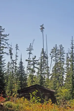
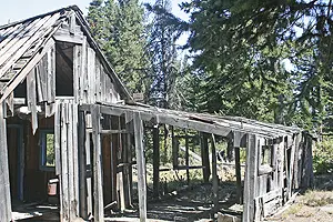
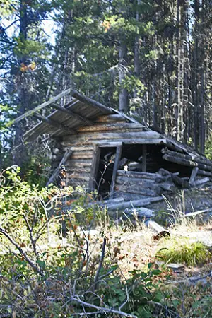
COMMENTS: From MT200, turn east on Garnett Range Road; proceed to Coloma turn off, (marked by BLM sign); turn left at sign and then take next right. Ruins are about 100 yards further. GPS Coordinates,North 46 degrees, 50.633 minutes West 113 degrees, 22.913 minutes. On the way to Garnett Ghost Town. REMAINS: Quite a few buildings. There is no interpretive data available on sight. Some of buildings out of sight in trees. |
| Called the "Mystery Camp," little information is available. The town was active from 1893 to 1906. During that period, the entire Coloma district produced approx. $250,000 in gold. The area was active again in 1918-1921 and 1932-1950. Current archological study of the site is being conducted by graduate school at University of Montana. Submitted by: M. S. "Doc" McClanahan |
Coloma Courtesy David Eggebraaten Coloma Courtesy David Eggebraaten |
| |