CAMP RENO
|
CAMP RENO |
|
|
|
|
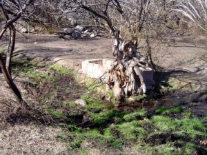
NAME: Camp Reno COUNTY: Gila ROADS: 4WD LEGAL INFO: 1 CLIMATE: Very cold winter mild summer BEST TIME TO VISIT: Winter or Early Spring |
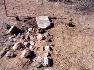
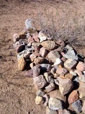
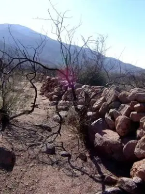
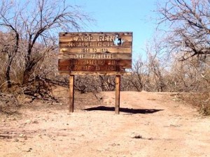
COMMENTS: From 188 at Punkin Center to the area called "Camp Reno" (in reality the general store area) on FR 409 by the forest service is about 3-ish miles. It's fenced in barbed wire and has a sign at the entrance erected by the Boy Scouts. The surrounding areas were severely damaged by the big fire, but finally beginning to show some green again. From 188 take 409 and stay on it, the road will split and one unnumbered road goes down to the wash, the site of a few skirmishes between the soldiers and the Apaches. (a fairly nice shaded spot to picnic) the road you want, bears right. The true area of Camp Reno, FR 524, is a bit further, depending on the road condition, it'll take 1/2 hour to 45 minutes. You'll need to look to your left when you get to the plateau area of the mesa, look for rock piles. This spot overlooks the area where the general store was located, but you can't access one area from the other because Camp Reno was located on the mesa plateau with a steep hill and a creek bed between. I suspect when the camp was operational, they probably had stairs built to get down to the store. There's not a lot to see in either location, but a lot of history took place there and we always like to imagine what it must have been like. Both areas are open (as of two weeks ago) The electric company has been in there laying underground power lines, so they've smoothed the road out considerably but four wheel drive is still recommended. UPDATE: The area that is fenced in was the original site for the ranch that was operated after the Apache days. The sign errected by the Boy Scouts sits on the site of the Sutlers Store and the building comprising the Camp itself begin directly across the "road" and goes South from there. The site on the mesa with the rocks is an indian ruin. The soldiers build a stockade up on the mesa and one can still see the nubs of the posts sticking out of the ground. I also found, in my explorations, a ramp and roadway tht was built to take people...etc from the stockade down to the "fort". One can even see where the roadway was built across Reno Creek and up the opposite hillside to the old camp. -CindyREMAINS: Very little if anything |
|
This area was occupied by the United States Army from 1867-1870.Their mission was to check on the Apaches. Submitted by: Mark Mayhew Camp Reno was established by the 1st Cavalry in 1867 and abandoned in 1870. It was an outpost of Fort McDowell and was intended to establish a military presence in Tonto Basin and surrounding areas due to the problems settlers and ranchers were having with regular raids by the Apaches. The actual orders from General McDowell to the 1st Cavalry Captain simply stated, |
|
|
|