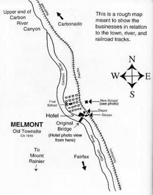
MELMONT
|
MELMONT |
|
|
|
|
NAME: Melmont COUNTY: Pierce ROADS: 2WD GRID: 1 CLIMATE: May be snow or muddy in winter BEST TIME TO VISIT: Anytime |
COMMENTS:
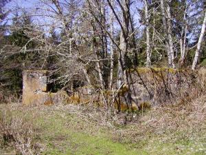
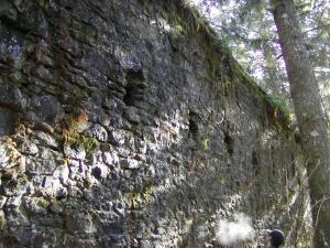
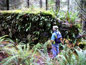
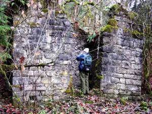
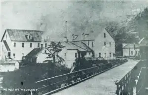
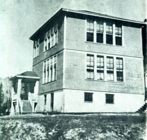
Melmont has no residents now. I was last to the Melmont site, November, 2002. It is about 4 miles south of Carbonado, WA, off of hwy 165, on an old railroad right of way. Go to the Fairfax Bridge (the cool bridge high above the Carbonado River). Park at the west side of bridge. Then walk across the bridge to the trailhead. Don�t forget to stop at the middle of the bridge to drop a rock, or just take in an awesome view. Melmont is about 1 mile from the trailhead. You'll hear the river on your right and natural springs on your left. Continue south (towards Mt. Rainier), to the Y in the path. Go to the left. Walk up the stream. You'll see the old School remains on the left up a ways, in a clearing.
Location coordinates for old school ruins: N 47° 01.847 W 122° 02.001 UPDATE: Parking on the west side of the bridge was easy because it was the only place to park. But the "trailhead" is definitely unmarked and suitable only for the able-bodied! You need to hop the guardrail and scale down the embankment grabbing the rails to the bridge for support. The destination is actually about 2 miles from the Fairfax Bridge, so it took about twice as long to get to the school remains than anticipated. The road to "town" is MUDDY! We had to battle nettle bushes on the sides of the muddy road so take caution! |
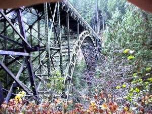
| On December 17, 1921, Pierce County opens the bridge (Fairfax Bridge)over the Carbon River at Melmont and names it after County Commissioner James R. O�Farrell. The bridge crosses the river about three miles south of Carbonado and provides the first highway access to the town of Fairfax via the Carbon River-Fairfax Road (present-day State Route 165 running south from Wilkeson to Carbonado to Fairfax), and also provides another route to Mount Rainier National Park. The span cost an estimated $500,000 to build and is said to be the highest bridge in the state. Submitted by: Ron McDonald |
|
|
|
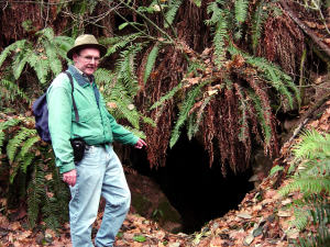
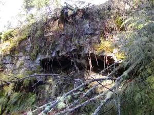
 Old Dynamite Shed